

Accurate Aerial Imaging Services, LLC

PRECISION AERIAL IMAGING & DRONE MAPPING
Aerial imaging services based in Dallas, Pennsylvania, supporting land evaluation, site visibility, and project-level visual documentation across NEPA.
Drone imaging, orthomosaic mapping, and aerial site documentation designed to support property review, construction activity, and technical project planning across Northeastern Pennsylvania.
Accurate Aerial Imaging Services, LLC (A.A.I.S.) provides aerial support where clear overhead data improves project understanding and decision-making.
Need a clearer view of a property, site, or project area?

Aerial Imaging for Site Analysis, Mapping & Technical Visibility
Accurate Aerial Imaging Services, LLC provides aerial support where overhead visibility improves documentation, site interpretation, mapping accuracy, and project review.
AERIAL IMAGING SERVICES
-
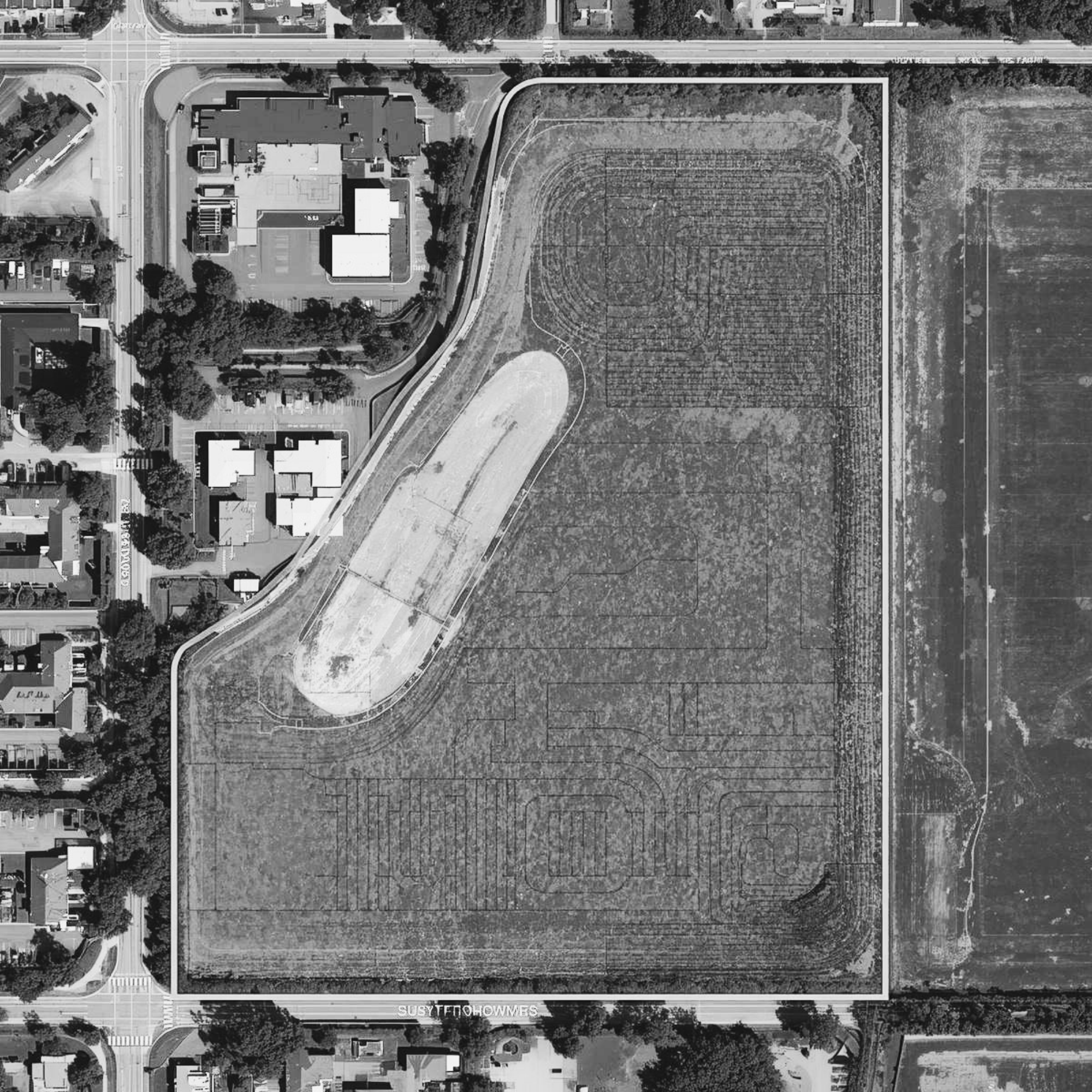
High-resolution aerial imagery used to document site conditions, property layout, access points, and surrounding land features with clear overhead perspective.
-
Georeferenced composite imagery that provides accurate overhead site representation for planning, comparison, and visual evaluation.
-
Aerial data processed to support three-dimensional visual representation of site conditions and land features.
-
Aerial image capture designed to document structures, land conditions, boundaries, and surrounding site context.
PROJECT DOCUMENTATION SUPPORT
-
Used to capture project stages over time, helping document visible site changes and construction progression.
-
Aerial perspectives that support broader understanding of parcel layout, site relationship, and surrounding conditions..
-
Aerial imagery used where overhead visibility strengthens project communication, review, and technical discussion.
-
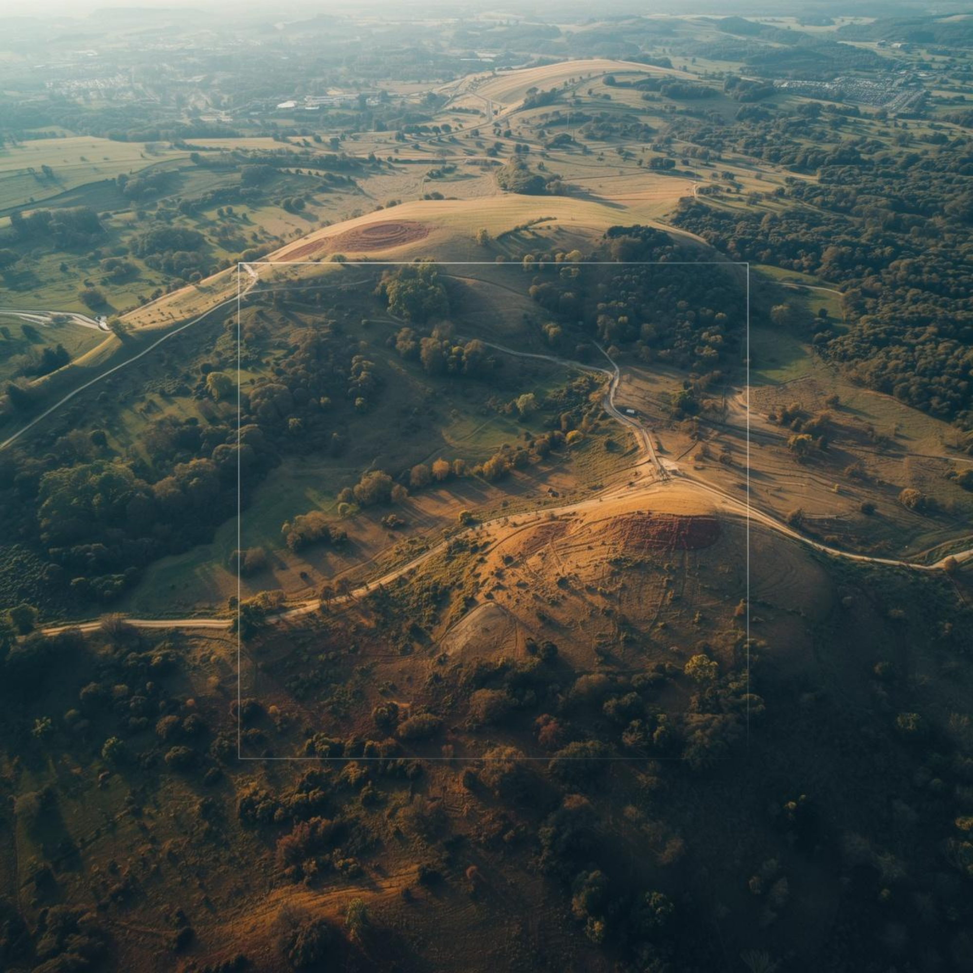
Aerial data processed to assist with site contour development, including three-dimensional surface representation that improves field efficiency and technical site evaluation.
A direct call helps determine the right aerial approach for your project.
Supporting Survey, Engineering & Site Evaluation
-
Survey Support
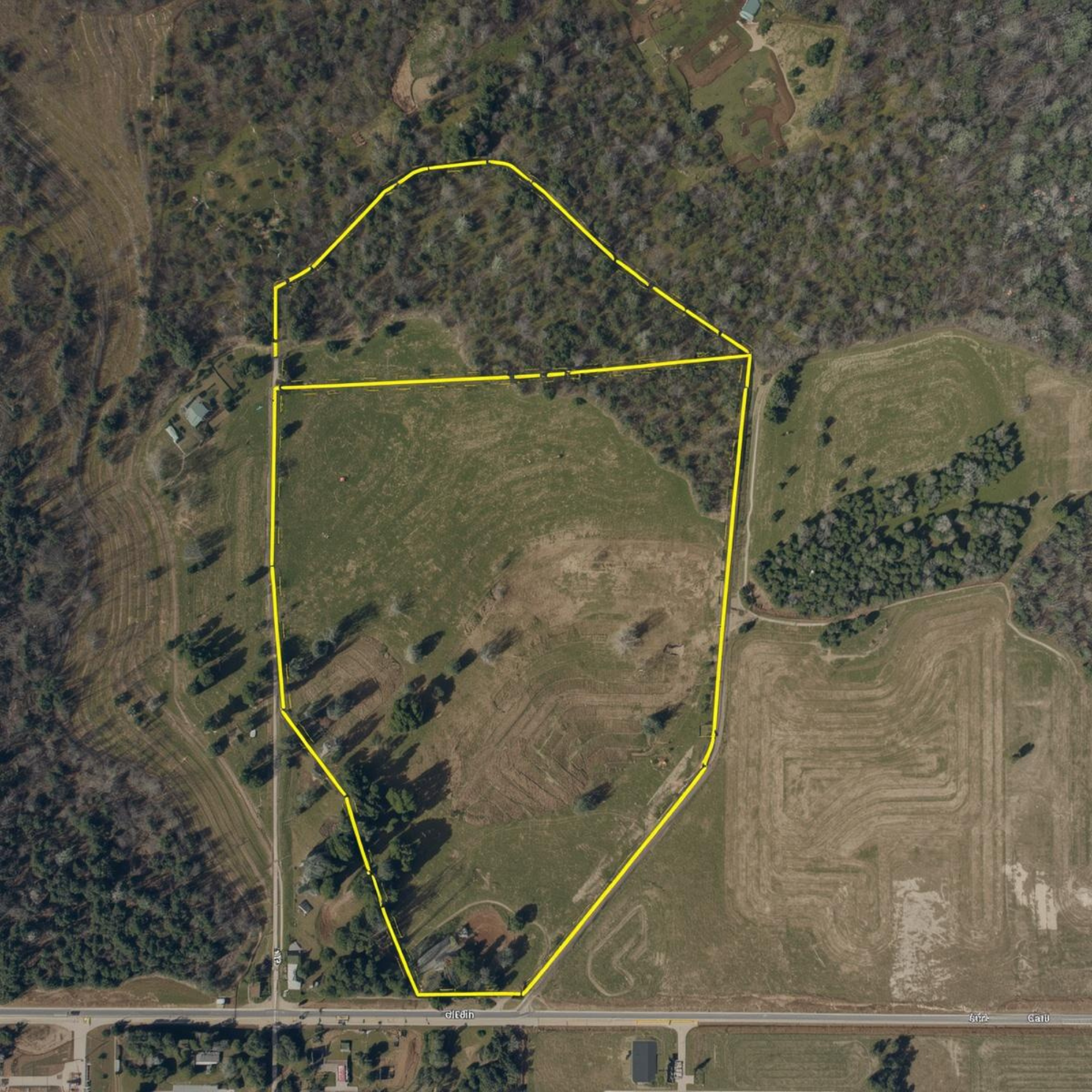
Aerial mapping supports boundary review, site evaluation, and field documentation needs.
-

Engineering Review
Overhead imagery supports technical review of site conditions and layout decisions.
-
Site Contour Interpretation
Aerial outputs assist with contour understanding and three-dimensional surface review.
-

Site Documentation
Aerial imagery captures site conditions, visible progress, and overall project perspective.
Technical Standards that Support Better Field Understanding
Clear aerial data becomes most valuable when visual accuracy supports technical review, field interpretation, and project decisions.
Aerial data becomes most useful when technical review depends on clear site visibility.
TECHNICAL BACKGROUND
FAA Part 107 Certified Remote Pilot
High-resolution aerial capture
Orthomosaic image production
3D rendering capability
Site contouring support
Overhead site perspective for visual analysis
TYPICAL PROJECT APPLICATIONS
Land development
Construction progress
Property review
Site planning
Technical documentation
Questions about whether aerial imaging fits your project? A brief call helps determine the right approach.
Speak Directly With Our Office
Questions involving aerial imaging, drone support, or site documentation are best addressed by phone.
A brief call helps us understand your needs and direct your inquiry appropriately from the beginning.
ACCURATE AERIAL IMAGING SERVICES, LLC
570-406-0727
LOCATION
Northeastern Pennsylvania

Serving Luzerne, Wyoming, Lackawanna, Wayne, Sullivan, and Susquehanna Counties – and projects across NEPA.
Accurate Aerial Imaging Services, LLC appears within the M.A.P.S. Services, Inc. network, where visitors may also access related land-development and technical service resources.